


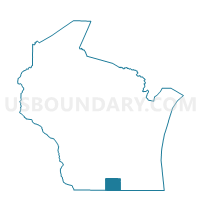
AVON - T 1 Voting District, Rock County, Wisconsin
About
Outline

Summary
| Unique Area Identifier | 696657 |
| Name | AVON - T 1 Voting District |
| County | Rock County |
| State | Wisconsin |
| Area (square miles) | 36.14 |
| Land Area (square miles) | 35.55 |
| Water Area (square miles) | 0.59 |
| % of Land Area | 98.37 |
| % of Water Area | 1.63 |
| Latitude of the Internal Point | 42.53888590 |
| Longtitude of the Internal Point | -89.29341700 |
Maps


Graphs
Select a template below for downloading or customizing gragh for AVON - T 1 Voting District, Rock County, Wisconsin


Neighbors
Neighoring Voting District (by Name) Neighboring Voting District on the Map
- LAONA 1 Voting District, Winnebago County, IL
- NEWARK - T 1 Voting District, Rock County, WI
- NEWARK - T 2 Voting District, Rock County, WI
- SHIRLAND 1 Voting District, Winnebago County, IL
- SPRING GROVE - T 1 Voting District, Green County, WI
- SPRING VALLEY - T 1 Voting District, Rock County, WI
Top 10 Neighboring County Subdivision (by Population) Neighboring County Subdivision on the Map
- Newark town, Rock County, WI (1,541)
- Laona township, Winnebago County, IL (1,250)
- Shirland township, Winnebago County, IL (988)
- Spring Grove town, Green County, WI (874)
- Spring Valley town, Rock County, WI (746)
- Avon town, Rock County, WI (608)
Top 10 Neighboring Elementary School District (by Population) Neighboring Elementary School District on the Map
Top 10 Neighboring Secondary School District (by Population) Neighboring Secondary School District on the Map
Top 10 Neighboring Unified School District (by Population) Neighboring Unified School District on the Map
- Brodhead School District, WI (6,404)
- Parkview School District, WI (6,093)
- Durand Community Unit School District 322, IL (4,010)
Top 10 Neighboring State Legislative District Lower Chamber (by Population) Neighboring State Legislative District Lower Chamber on the Map
- State House District 68, IL (117,743)
- State House District 89, IL (106,266)
- Assembly District 80, WI (60,352)
- Assembly District 43, WI (57,584)
Top 10 Neighboring State Legislative District Upper Chamber (by Population) Neighboring State Legislative District Upper Chamber on the Map
- State Senate District 34, IL (221,480)
- State Senate District 45, IL (209,870)
- State Senate District 27, WI (197,821)
- State Senate District 15, WI (170,251)
Top 10 Neighboring 111th Congressional District (by Population) Neighboring 111th Congressional District on the Map
Top 10 Neighboring Census Tract (by Population) Neighboring Census Tract on the Map
- Census Tract 41, Winnebago County, IL (5,302)
- Census Tract 9608, Green County, WI (4,342)
- Census Tract 27, Rock County, WI (2,571)